Cyclones
Sigma (1896)
Leonta (1903)
Floods
1946
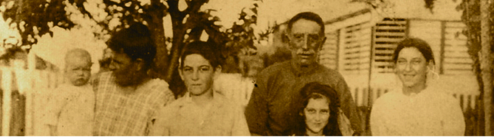
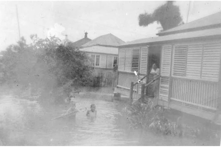
Some family photos below. A good account of the floods, by one of
my great-Uncles is here:
Flood was nothing like the old days…….
Another account (by a great-Aunty) is here:
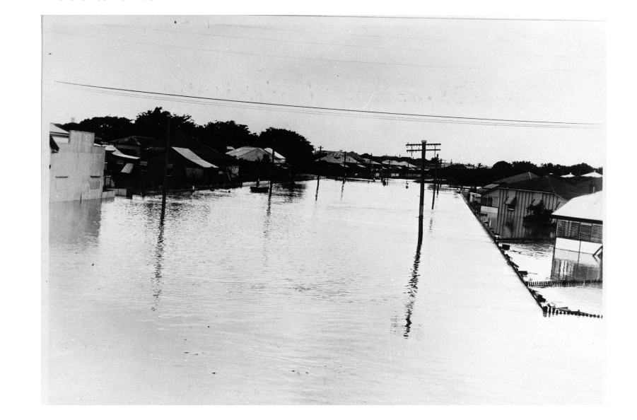
March 1946 – Townsville Floods
And some family pictures (don’t know exactly where they were taken, I don’t have the originals, or the history behind them):
South Townsville Bowls Club

Thank you for the 1946 Flood photographs. I wonder if you have any details or captions for the houses and streets portrayed? Cheers
Hi Jeff – no I don’t but I am looking for the information. I think tracing a family tree should include the history of where the family grew up (much more interesting). So when I come across any information on houses and streets, I’ll post it, but only if it protects the privacy of the current residents. Thanks for your comment.
Cheers and Thanks nqfamily
Hi again! I’m wondering if the person who posted the two 1946 Flood pics would have them digitally enhanced at Officeworks. Cost is only about 10 cents per copy. The first pic appears to be possibly along part of Plume St near the ‘dog leg’ where it becomes Allen Street. Back in the days when I was a child I can remember what some of that area looked like.
Again in the first pic the facade on the left looks like a shop that was once there (not sure what type of shop it was though) but back towards the photographer and not in the pic is another shop on the corner of Griffith and Plume St’s that was a bakery and cake shop. The actual building is still there and trades as a Laundry. The other thing about the site is that opposite the facade and on the right side of the pic you will notice that the houses are set at a skewed angle to the street and back when I was a kid they looked like that. Also note that the low-set is angled one way and the what looks like a high-set or flats is angled in a different direction.
Not certain now what explanation was given to me at the time but one thing I distinctly remember is that during the wet season those houses on the dog-leg were always surrounded by water because it was very low lying on that side of the St. Also if it is the area I think it is there was and old corrugated iron type corner store near the dog-leg run by a Chinese family and it was also water-logged during the wet season. The shop was back towards the photographer and not showing in this pic. The shop also had a palm tree in the front. It had grown really tall and spindly like they do. It was still there during the 1950’s.
Hope some of that helps. I can still distinctly see some of those scenes in my head. If I’m incorrect about the street I happy to be corrected.
When I saw the first pic I also grappled with it being Railway Avenue because the facade on the left looks quite like the facade of the Plaza or Estate (Picture) Theater (the building is still there). I discounted it because I don’t recall the houses opposite being so close. Where they are today is where they have always been. So it’s more likely Plume etc.
Another thing about the first pic is that it appears as though the photographer was up at a higher level and that’s possible in both scenarios. In my first one the Bakery had a house on top with a verandah across the front. In the second the only high point in that photographic position would be the first floor verandah of the National Hotel as it was back then but is now called the Ross Island Hotel. I have many other thoughts on those pics.
Cheers and hope to hear comments from others.
Jeff West